
We make some datasets freely available to the marine robotics community for research into navigation and mapping.
A Bathymetric Mapping Data Set With HighPrecision Ground Truth for Marine Robotics
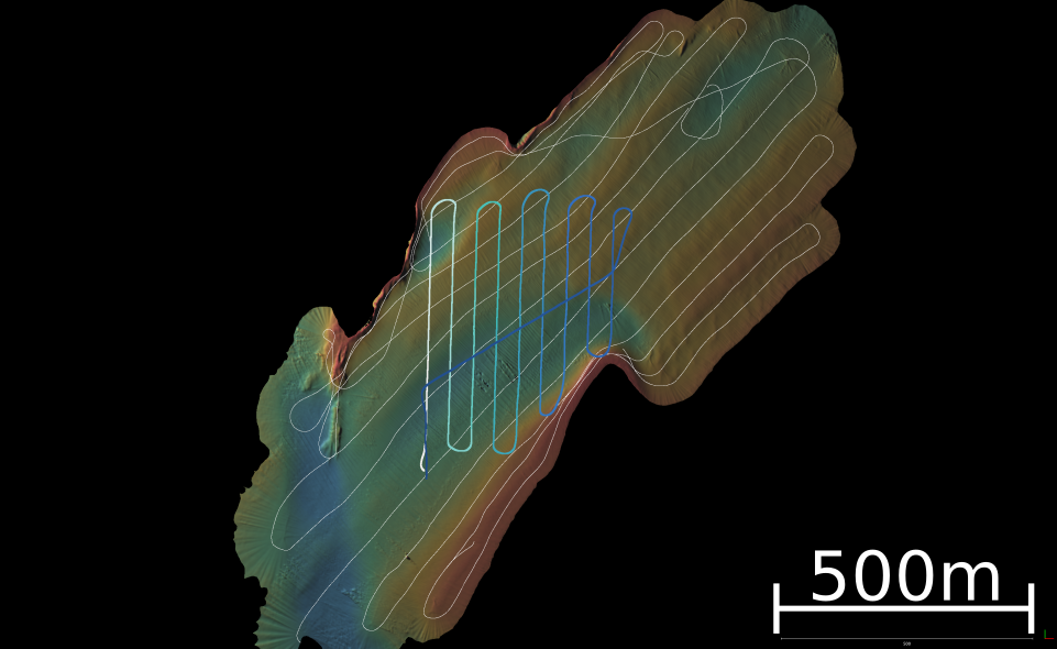
In recent years, sonar systems for surface and underwater vehicles have increased in resolution and become significantly less expensive. As such, these systems are viable at a wide range of price points and are appropriate for a broad set of applications on surface and underwater vehicles. However, to take full advantage of these high resolution sensors for seafloor mapping tasks an adequate navigation solution is also required. In GPS denied environments this usually necessitates a simultaneous localization and mapping (SLAM) technique to maintain good accuracy with minimal error accumulation. Acoustic positioning systems like ultra short baseline (USBL) and long baseline (LBL) are sometimes deployed to provide additional bounds on the navigation solution but the positional uncertainty of these systems is often much greater than the resolution of modern multibeam or interferometric side scan sonars. As such, sub-surface vehicles often lack the means to adequately ground truth navigation solutions and the resulting bathymetic maps. In this paper we present a dataset with four separate surveys designed to test bathymetric SLAM algorithms using two modern sonars, typical underwater vehicle navigation sensors, and high precision (2cm horizontal, 10cm vertical) RTK GPS ground truth. Additionally, these data can be used to refine and improve other aspects of multibeam sonar mapping such as ray-tracing, gridding techniques and time-varying attitude corrections.