

Let’s start with a little science background. Methane seeps are unique locations on the seafloor where natural methane deposits bubble up through the rocks and sediment. In some locations an ice-like material known methane hydrate can also form. These areas are of particular interest because of the unique ecosystems that form around them. You can find out a bit more about the expedition here on in the video above.
My mission on this cruise was to create high resolution maps around known methane bubble sites. Using these maps geologists can observe how the seeps affect the topology of the seafloor and also detect past seep sites. Backscatter information allows biologists to classify areas of “shell hash” produced by hard-shelled chemo-synthetic organisms around the seep sites. Finally, higher altitude surveys allowed the ROV team to locate new bubble streams which could be investigated and sampled later using gas samplers.
Beyond Bathymetry
The needs of this mission went a little beyond the typical ROV mapping operation. The lead scientists did want background maps but they also needed to detect a few things not directly visible in bathymetry.
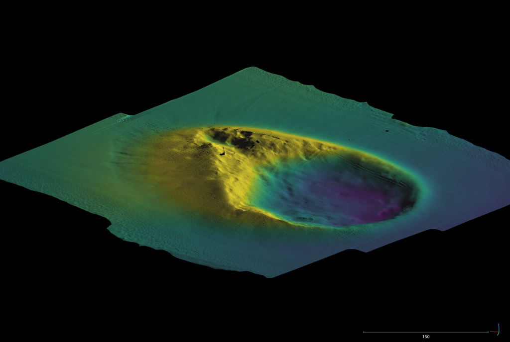
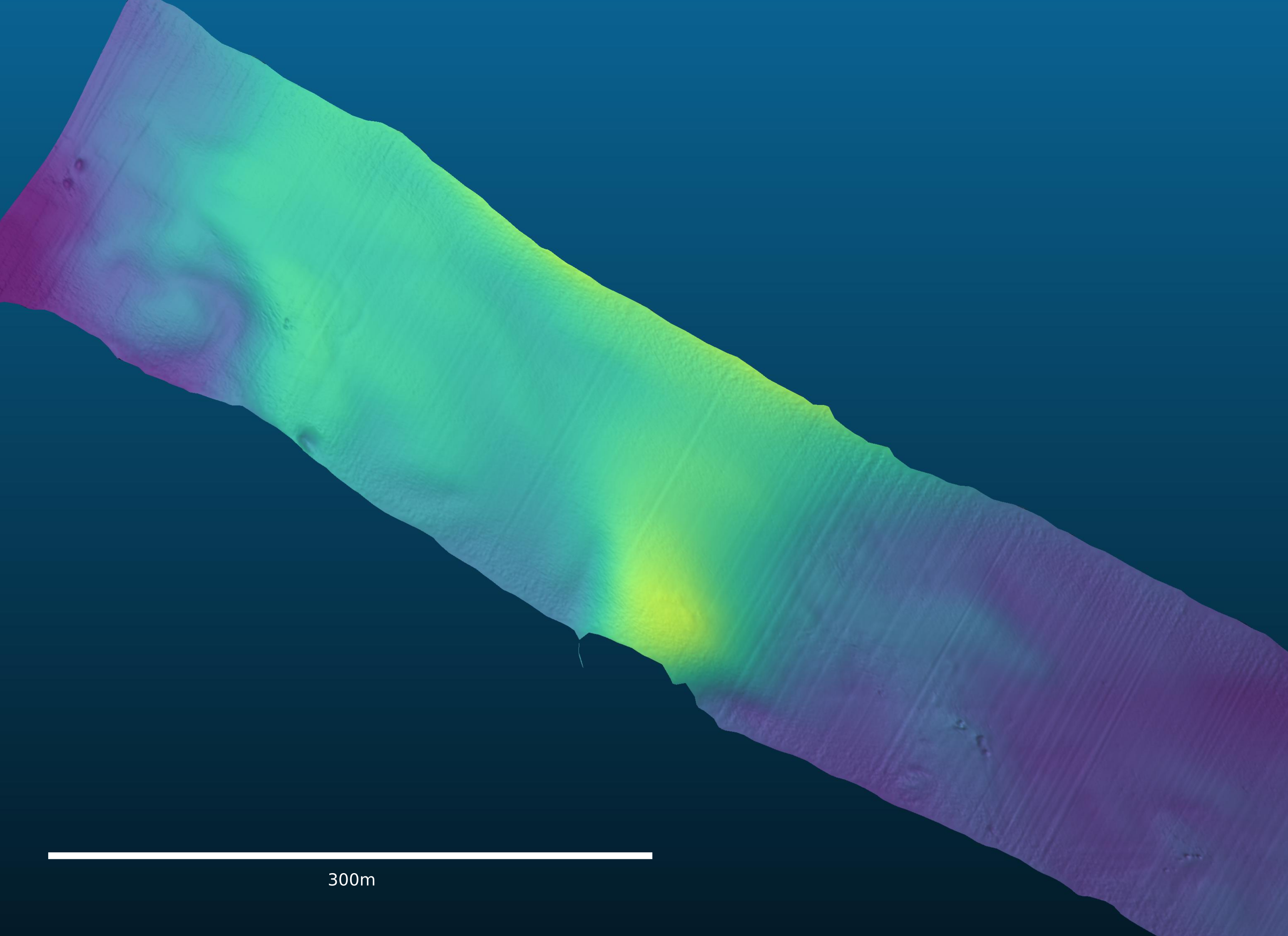
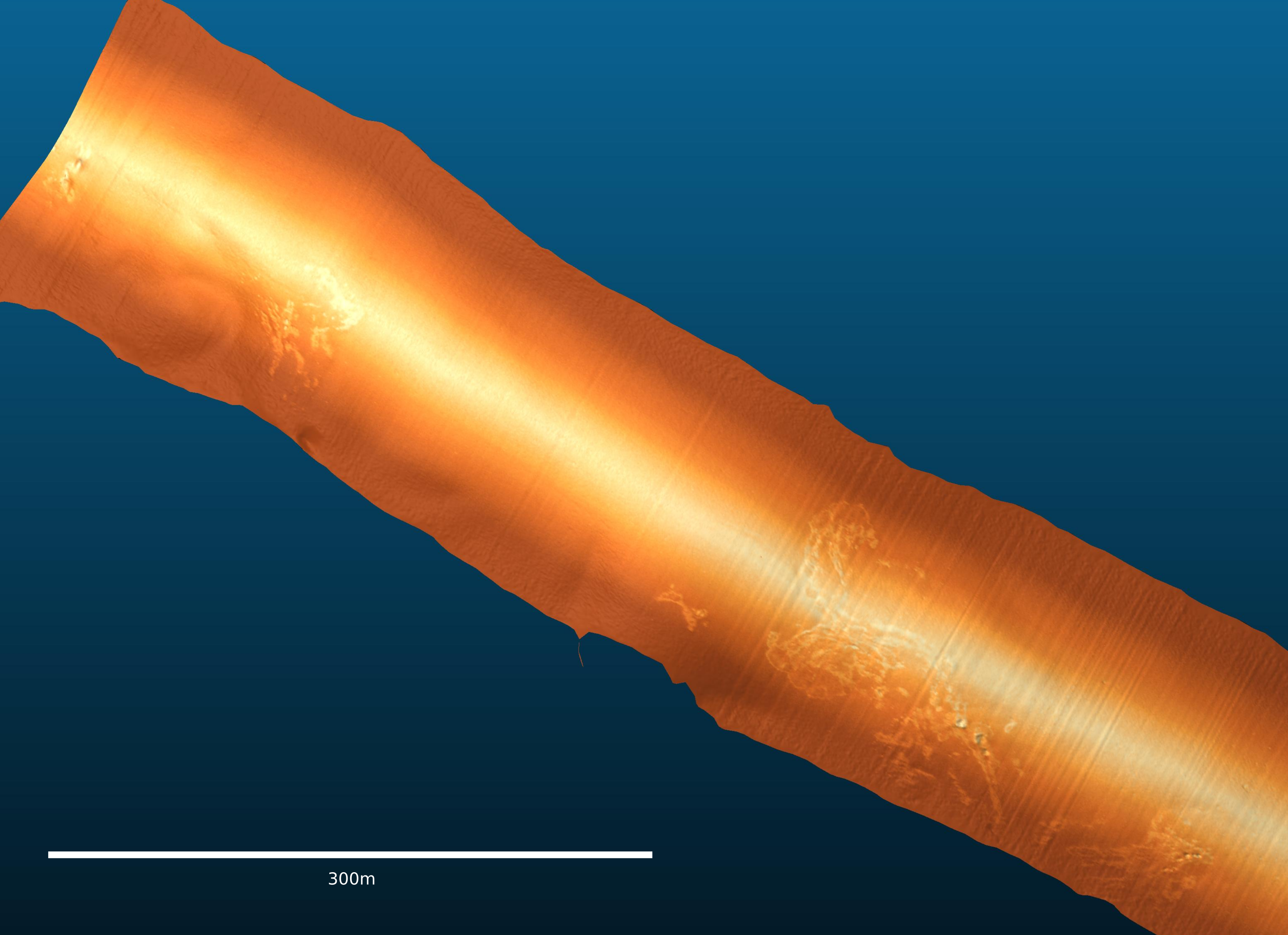
The scientists needed to detect seep habitat on the seafloor. This habitat has very little relief and is hard to see in simple bathymetry. However, much harder than the surrounding muddy seafloor because of the calcareous shell hash produced by the resident mollusks. This makes it an ideal target to detect with acoustic backscatter.
We conducted several single pass surveys over known seep sites. Although the bahthymetry was relatively mundane a backscatter overlay reveals beautiful patterns of shell hash and other hard biological buildup. Use the slider below to compare they bathymetric colormap with the backscatter overlay.
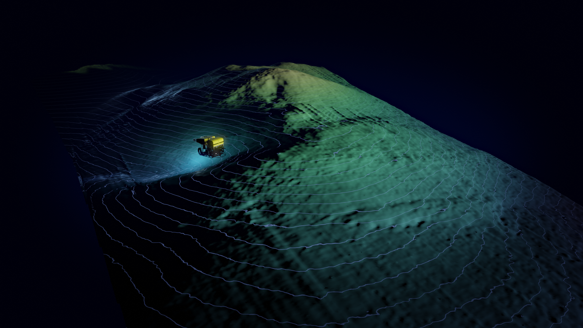
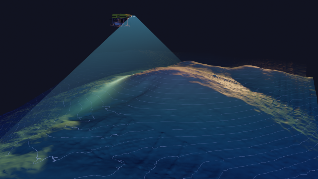
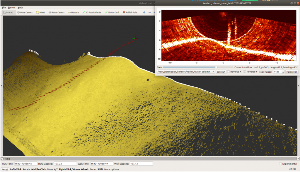
Another primary mission was bubble hunting. The ROV was equipped with gas samplers to retrieve specimens of seeped methane. Methane bubble streams are hard to detect visually but produce a very bright acoustic return. Water column data was recorded during mapping operations to help locate these bubble streams. The sonar could also be aimed forward to look for bubbles in front of the vehicle out to 50+ meters.
No responses yet