

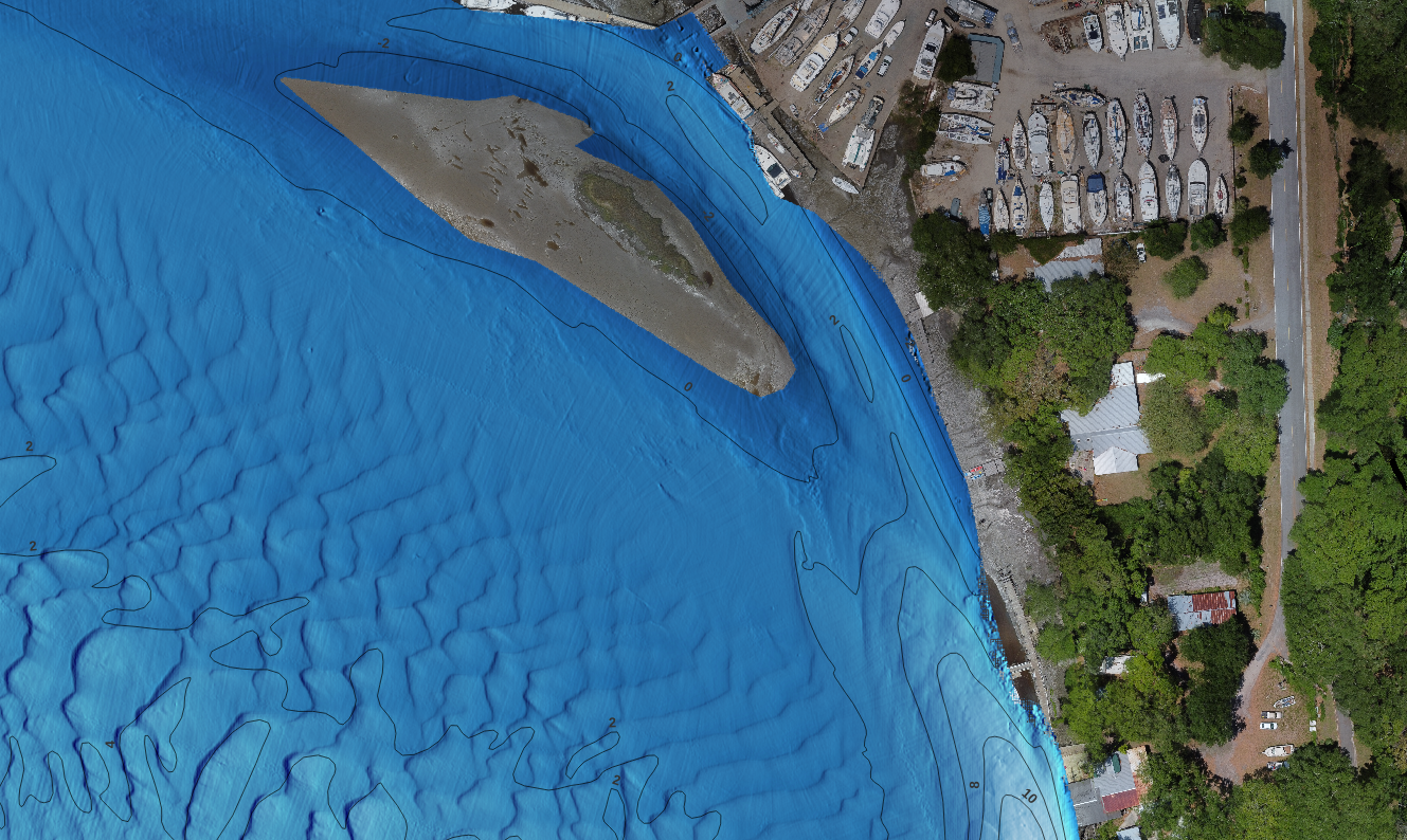
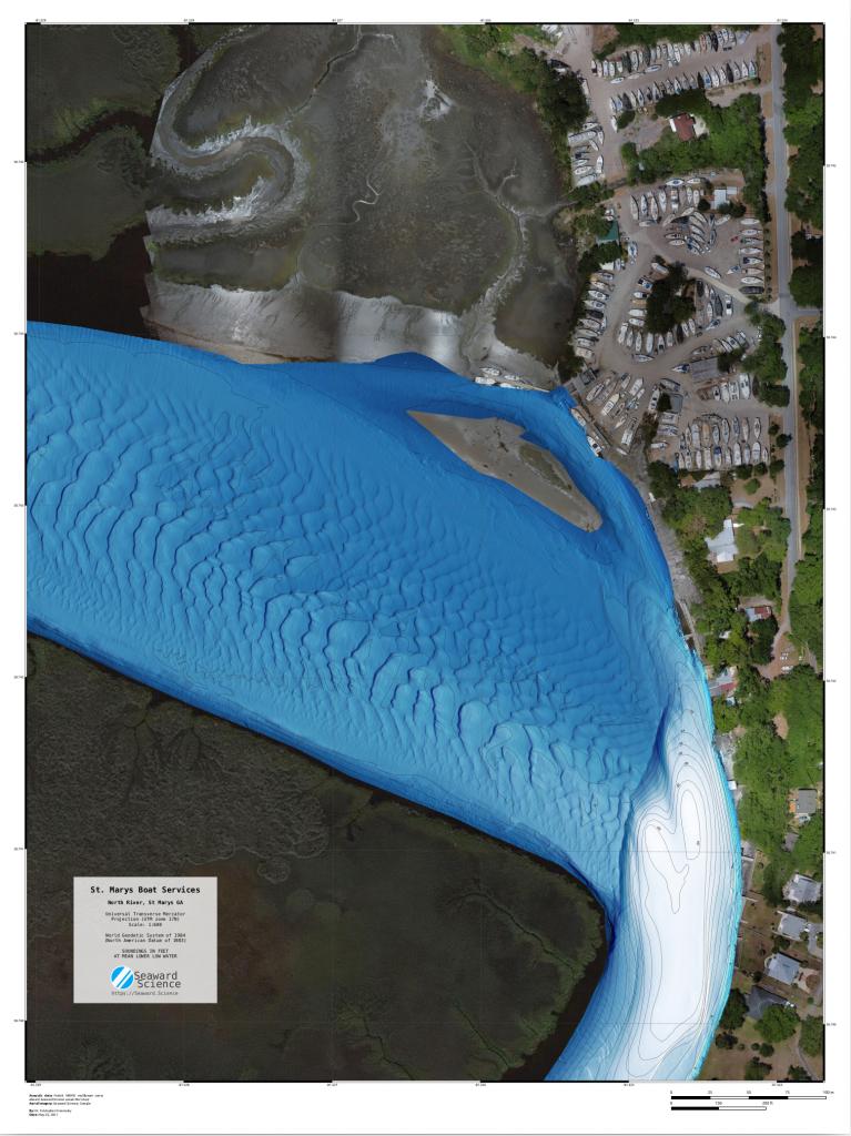
In May 2021 we were tasked with mapping the St. Mary’s Boat Services boatyard and nearby waterways. The customer wanted a chart to best advice boat owners on their entry to the boat well, locate any obstacles on the approach, and monitor shoreline erosion. Additionally, the customer requested photographic aerial survey of the boatyard to for yard planning.
This survey was completed with our new survey vessel Meri Aura, “Aura” for short. She is equipped with a high precision navigation sensors and a retractable mount for various survey sonars.
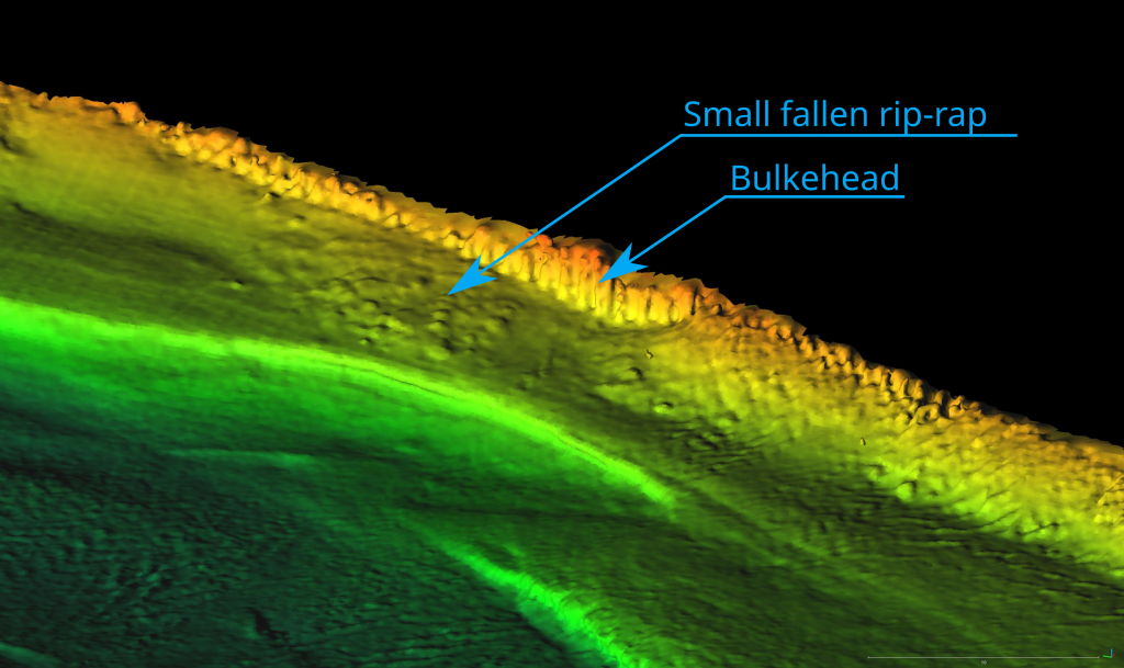
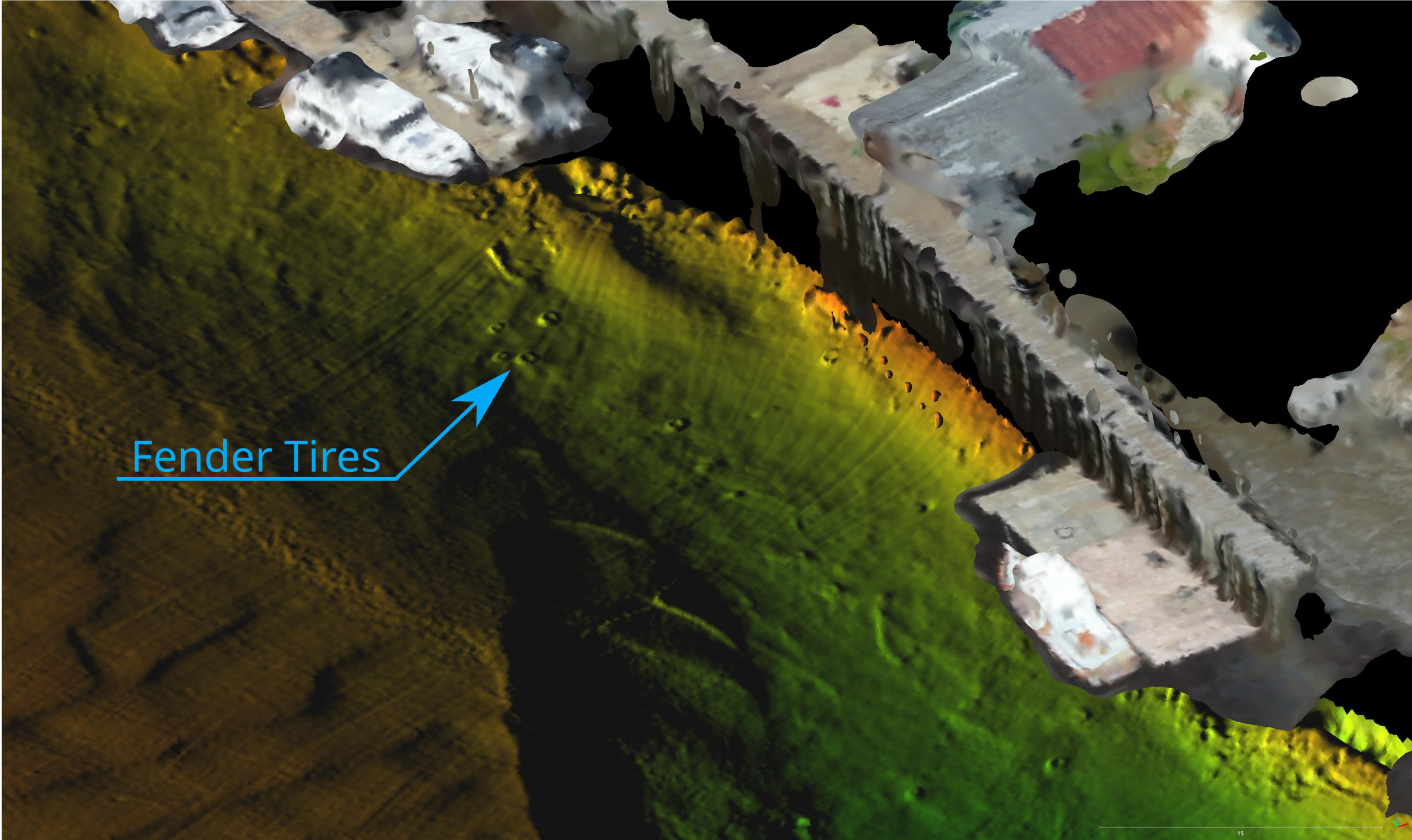
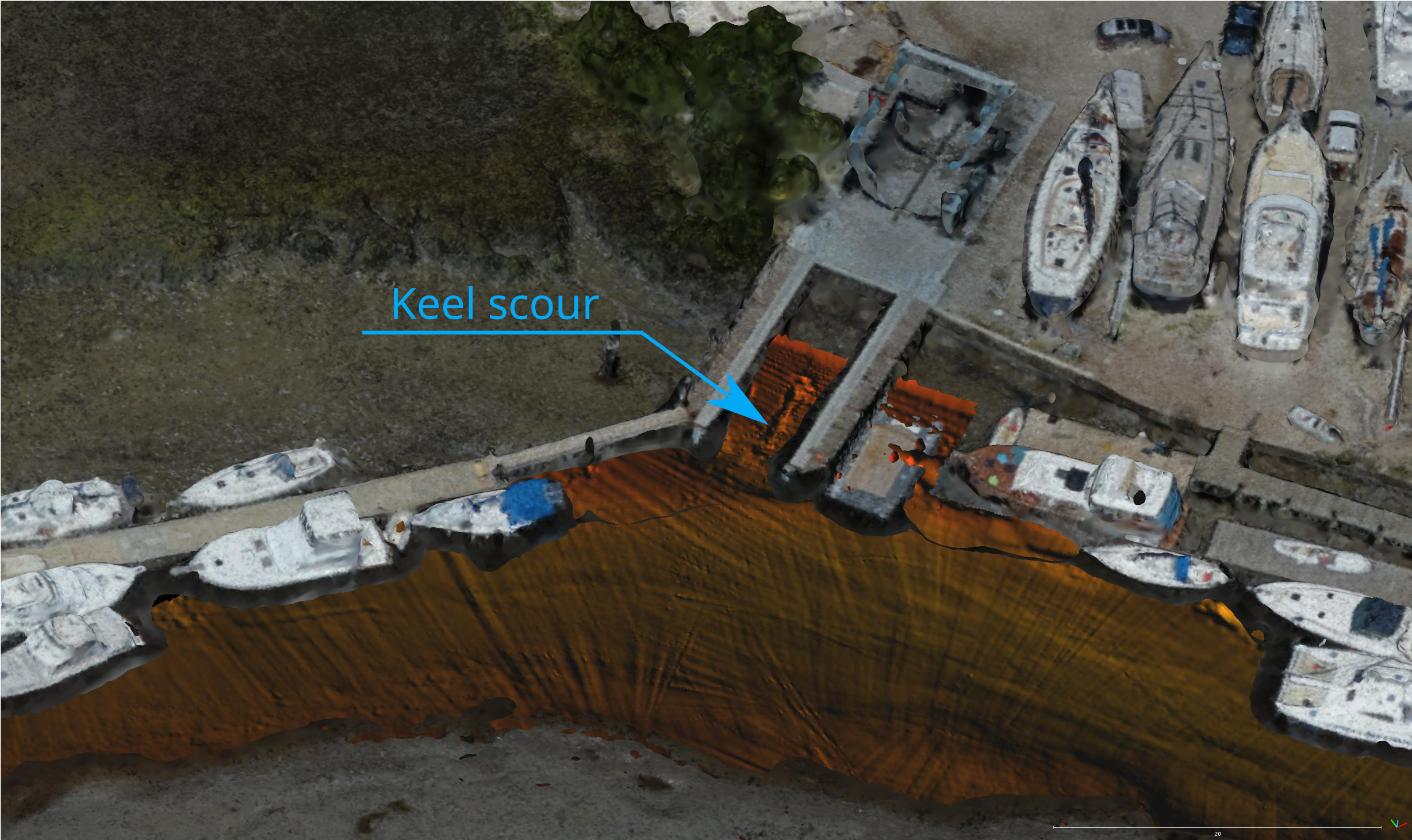
For this survey we used our Norbit 400khz multibeam echo sounder. It’s wide beam makes shallow water survey like this quick to complete and allows us to efficiently measure shoreline structures. With it’s high frequency we are able to effectively capture small scale structures. Take a look a the gallery below for some examples of the kinds of details we spotted.
Comments are closed